The Prosecco hills: a cultivated chequerboard of steep terrain
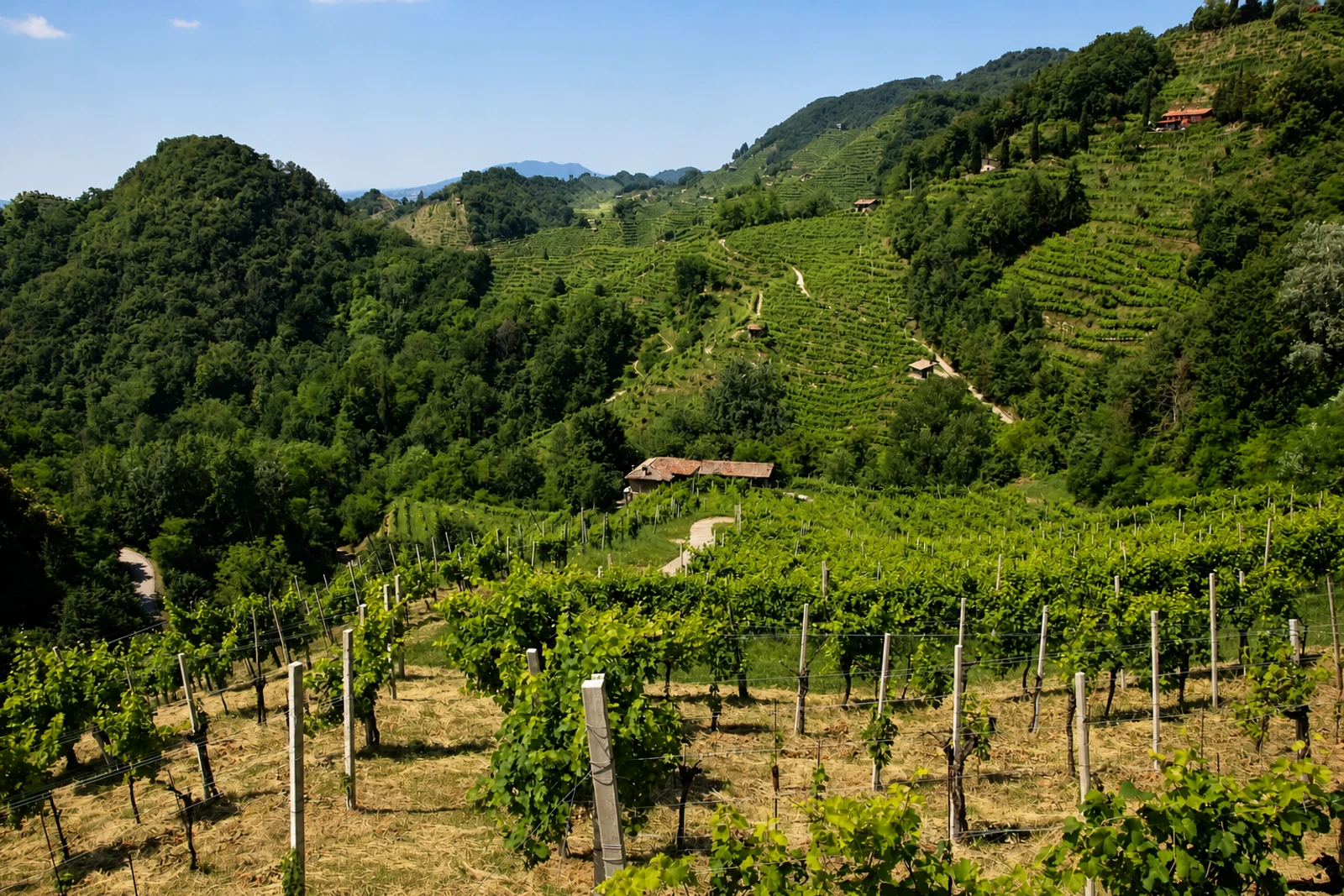
Le Colline del Prosecco di Conegliano e Valdobbiadene belongs on this map because UNESCO recognises a cultural landscape shaped by the interaction of nature and people over several centuries. In north-eastern Italy, hogback hills give the winegrowing area a pronounced mountain character. Vineyards do not stand alone: forests, small woodlands, hedges, tree rows, villages and farmland form a mosaic across the slopes.
The detail to look for is the ciglione, a narrow grassy terrace carrying small plots of vines along steep contours. Used since the 17th century, these terraces help stabilise soils and create the distinctive pattern of vine rows running both parallel and vertically to the hillsides. The bellussera vine-training technique, developed by local farmers in the 19th century and associated with the area from about 1880, adds another recognisable element.
This is not simply an agricultural destination or a collection of vineyards. UNESCO’s criterion (v) concerns the land-use system itself, including hand management and continuing manual harvesting, as well as the landscape patterns associated with sharecropping. Villages sit in narrow valleys or on crests, and forest patches provide corridors between habitats. That combination distinguishes the property from a purely scenic wine route: its heritage value is the continuing relationship among terrain, cultivation, settlement and ecological structure. Conservation remains attentive to landslides, architectural elements and pressures associated with the global Prosecco market.