
.jpeg)
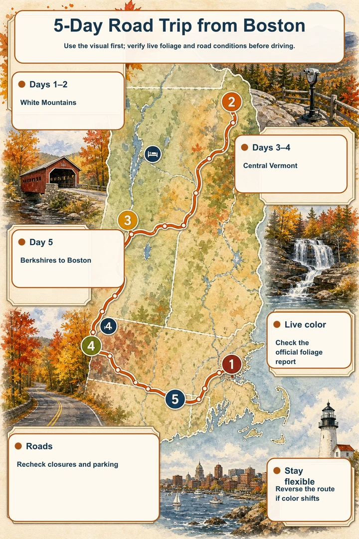
Use the visual first; verify live foliage and road conditions before driving.
- Days 1–2White Mountains
- Days 3–4Central Vermont
- Day 5Berkshires to Boston
- Live colorCheck the official foliage report
- RoadsRecheck closures and parking
- Stay flexibleReverse the route if color shifts
Use the map as the trip’s planning dashboard
Follow the pins in sequence rather than treating every stop as mandatory. The route leaves Boston for the White Mountains, crosses into central Vermont, then returns through western Massachusetts before ending in Boston. Pin clusters show where a scenic drive can become a crowded stop sequence, especially along the Kancamagus Highway.
Use the map’s current routing estimates for each leg instead of relying on a fixed printed drive time. Weather, leaf traffic, road conditions, and full pull-offs can add delay. Keep one or two stops flexible each day, and use the map to identify the next legal alternative before leaving the road.
The route at a glance: two bases, limited backtracking
Spend nights one and two around Lincoln or North Conway for access to the Kancamagus Highway, Franconia Notch, and Crawford Notch. Spend nights three and four around Woodstock or elsewhere in central Vermont for Route 100, Vermont Route 17, Quechee, and the return toward Massachusetts.
This arrangement avoids turning every day into a relocation day. The White Mountains provide the concentrated New Hampshire portion, while central Vermont makes the covered bridges, gorge, mountain pass, and western Massachusetts stops easier to combine on the way back.
Five-day itinerary
Day 1 — Boston to the White Mountains: Leave Boston and drive toward the first base. If conditions and arrival time allow, begin with the Kancamagus corridor and choose a small number of stops in legal parking areas. Albany Covered Bridge and Rocky Gorge make a logical early pairing; Sabbaday Falls and Pemigewasset Overlook can fill the route when parking and daylight cooperate. Stay near Lincoln or North Conway.
Day 2 — Franconia and Crawford Notch: Make Flume Gorge the main planned visit, allowing two to three hours and checking its current admission and reservation details. Continue toward Crawford Notch Depot for a historic valley stop, then return to the same White Mountains base. This keeps the day scenic without requiring another hotel move.
Day 3 — White Mountains to central Vermont: Cross toward Vermont and use Moss Glen Falls in Granville as a Route 100 roadside stop. Continue to the central Vermont base around Woodstock. Treat the waterfall as a brief pull-off, not a reason to stop in the travel lane, and keep the map open for current road conditions and alternate routing.
Day 4 — Vermont loop: Build the day around Appalachian Gap, Quechee Gorge, and Middle Covered Bridge in Woodstock. Appalachian Gap requires extra care on a steep, winding road; Quechee and Woodstock are more conventional walking stops but can be busy. Return to the same central Vermont base.
Day 5 — Berkshires to Boston: Use Mount Greylock Summit if its seasonal auto roads are open and current DCR notices support the climb. Mount Sugarloaf State Reservation is another possible viewpoint farther south, with a seasonal summit road and hiking alternative. Choose based on the live road report, then continue to Boston. Do not plan both summits as fixed requirements if the return schedule is tight.
Plan with historical windows, not a promised peak date
The supplied stop data places the White Mountains stops generally in late September to early October, central Vermont stops from late September to mid-October, and the Massachusetts viewpoints from late September to mid-October, with Mount Sugarloaf extending into late October. These are planning windows only, not a 2026 peak forecast.
Exact 2026 color timing remains TBA until a live official foliage report confirms current conditions. Check New Hampshire, Vermont, and Massachusetts foliage or road reports shortly before departure, then adjust the map’s stop order rather than assuming every elevation and valley will peak together.
How to handle crowded pull-offs and changing conditions
Kancamagus pull-offs can fill early on peak weekends. Start early, obey signed parking rules, and do not improvise a roadside stop when the designated area is full. If a high-demand viewpoint is unavailable, continue to the next mapped stop instead of circling or stopping on the shoulder.
Keep a legal fallback in each cluster: a covered bridge or river stop on the Kancamagus corridor, a waterfall or valley stop near Route 100, and a town walk around Woodstock. Flume Gorge needs the most advance attention because it is a ticketed walk and timed admission may be used during foliage season.
Access, passes, and road checks
Several stops are roadside or short walks, but mountain roads are not interchangeable with ordinary scenic streets. Appalachian Gap is steep and winding, while Mount Greylock and Mount Sugarloaf use seasonal summit roads that may close for weather. Check official alerts and DCR notices before committing to those climbs.
Fees vary by site. White Mountain National Forest recreation passes may be required at signed locations, Flume Gorge has paid admission, Vermont state park facilities may charge a day-use fee at Quechee Gorge, and parking fees may apply at the Massachusetts summits. Confirm current rules before departure rather than budgeting from an assumed universal pass.
Why Acadia is intentionally excluded
Acadia is not part of this loop because adding it would create excessive driving for a five-day itinerary that already includes Boston, the White Mountains, central Vermont, and the Berkshires. The western route keeps the trip focused on connected mountain roads, gorges, covered bridges, and valley viewpoints.
Leaving Acadia out also protects the two-base structure. Instead of sacrificing a night to a distant coastal transfer, this plan gives the White Mountains and central Vermont two nights each, with the Berkshires serving as a flexible return corridor.
A compact loop with room to adapt
The strength of this Boston foliage trip is its shape: two nights in the White Mountains, two around central Vermont, and a final western Massachusetts decision point before Boston. The map keeps the route readable while allowing crowded pull-offs, seasonal roads, and live foliage reports to change the day’s exact sequence.
Treat the itinerary as a framework, not a checklist. Start early on high-demand corridors, verify official reports, and choose fewer legal stops when traffic or weather slows the route. That approach preserves the scenic variety without turning five days into a race.
Places in this article
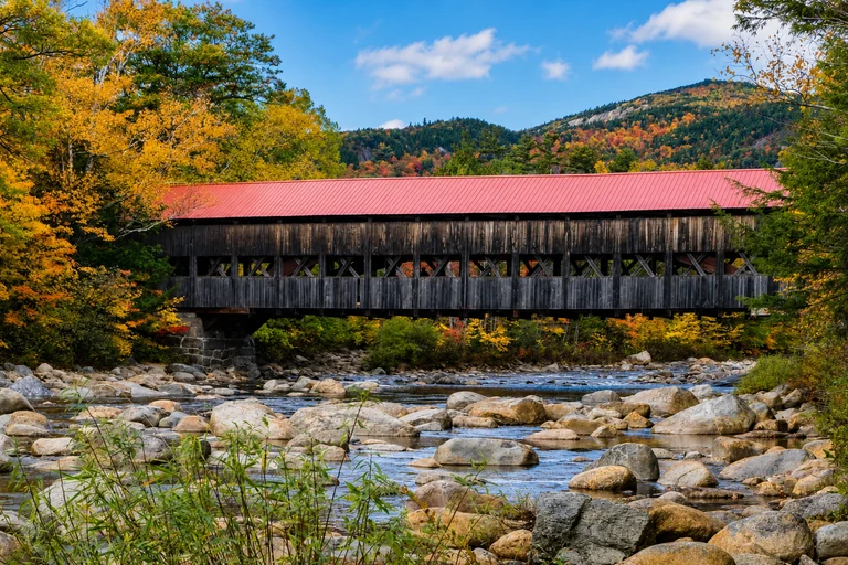
Albany Covered Bridge
Albany Covered Bridge is a compact opening stop on the Kancamagus Highway, combining a historic covered bridge with a river setting. Its 30–45 minute visit fits well before longer walks and helps break up the east-to-west drive toward the White Mountains base.
The bridge is a short walk from parking, but check White Mountain National Forest alerts before departure. A recreation pass may be required at signed sites, so confirm the current rule and use only designated parking.
AI-created illustrative image; not a documentary photographAnyMappy · AI-edited from a rights-cleared reviewed reference · AI-generated editorial imageImage source
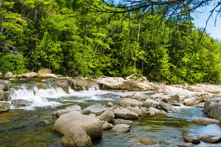
Rocky Gorge Scenic Area
Rocky Gorge provides a short-path gorge and river viewpoint on the Kancamagus corridor. It is useful as a focused 30–45 minute photography stop, especially when the itinerary needs scenery without adding a long hike.
The area can be crowded, and swimming is not permitted in the gorge. A White Mountain National Forest recreation pass may be required, so check alerts and parking conditions before making it a fixed stop.
AI-created illustrative image; not a documentary photographAnyMappy · AI-edited from a rights-cleared reviewed reference · AI-generated editorial imageImage source

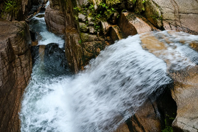
Sabbaday Falls
Sabbaday Falls adds a waterfall walk to the Kancamagus sequence and takes about 45–75 minutes for the roughly 0.6-mile round trip. Choose it when the group wants a brief forest hike rather than another roadside overlook.
The broad trail is family-friendly in character, but current trail conditions still need verification. Parking and recreation-pass requirements can affect the stop, particularly when the corridor is busy.
AI-created illustrative image; not a documentary photographAnyMappy · AI-edited from a rights-cleared reviewed reference · AI-generated editorial imageImage source
.jpg)
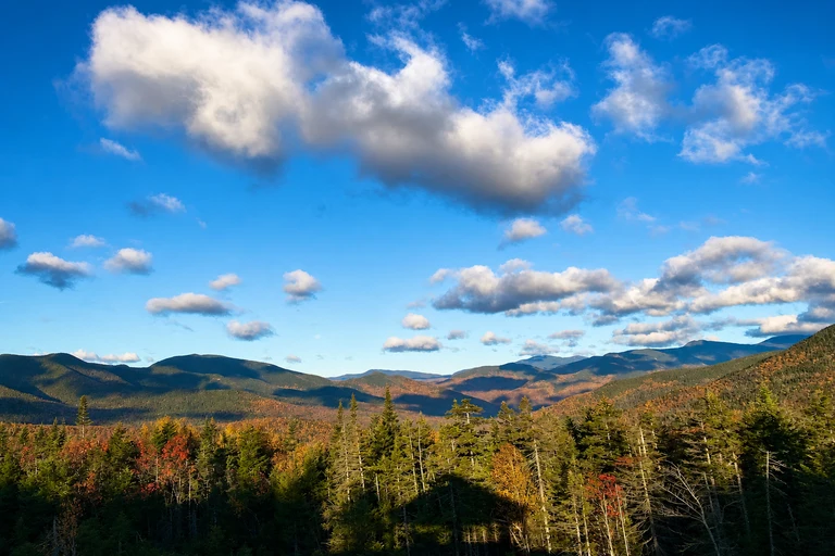
Pemigewasset Overlook
Pemigewasset Overlook is a quick, paved roadside viewpoint with a broad mountain panorama near Lincoln. Its 15–30 minute visit makes it a useful final Kancamagus stop before reaching the White Mountains base or a flexible substitute when a longer stop is not practical.
Parking fills quickly during peak weekends. Follow signed parking and pass requirements, and do not treat the overlook as guaranteed simply because it is roadside; use the map to move on if the area is full.
AI-created illustrative image; not a documentary photographAnyMappy · AI-edited from a rights-cleared reviewed reference · AI-generated editorial imageImage source
.jpg)
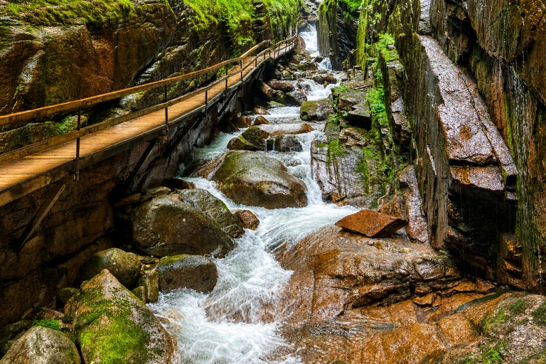
Flume Gorge
Flume Gorge is the most substantial planned walk in the New Hampshire section, with a full loop that generally takes two to three hours. The ticketed gorge combines stairs, uneven surfaces, and waterfalls, making it a strong anchor for Day 2 rather than an incidental stop.
Admission is paid, and timed reservations may be used during foliage season. Verify current operating and reservation details before departure, then allow enough time for the full walk instead of placing it between tightly timed driving legs.
AI-created illustrative image; not a documentary photographAnyMappy · AI-edited from a rights-cleared reviewed reference · AI-generated editorial imageImage source

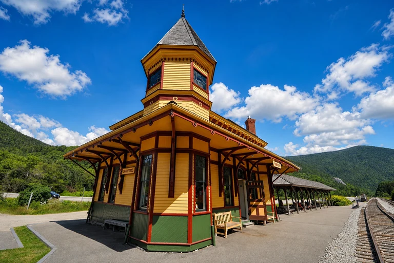
Crawford Notch Depot
Crawford Notch Depot is a concise historic and valley stop on the US 302 route through Crawford Notch. Its 30–60 minute range gives the second New Hampshire day a different character after the gorge and waterfall scenery around Lincoln.
Access is roadside near the historic depot, but seasonal facilities and trail conditions should be confirmed. Roadside viewing is free, while nearby parking or attractions may have separate rules.
AI-created illustrative image; not a documentary photographAnyMappy · AI-edited from a rights-cleared reviewed reference · AI-generated editorial imageImage source

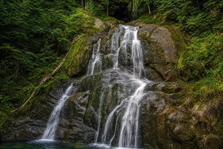
Moss Glen Falls in Granville
Moss Glen Falls is a short Route 100 stop that works well during the transfer from the White Mountains to central Vermont. A 20–40 minute visit adds a waterfall and boardwalk without requiring a major detour from the central Vermont route.
Use the signed pull-off and never stop in the travel lane. No attraction admission is normally required, but the stop remains dependent on safe parking and current Vermont road conditions.
AI-created illustrative image; not a documentary photographAnyMappy · AI-edited from a rights-cleared reviewed reference · AI-generated editorial imageImage source
_2_(49437678742).jpg)
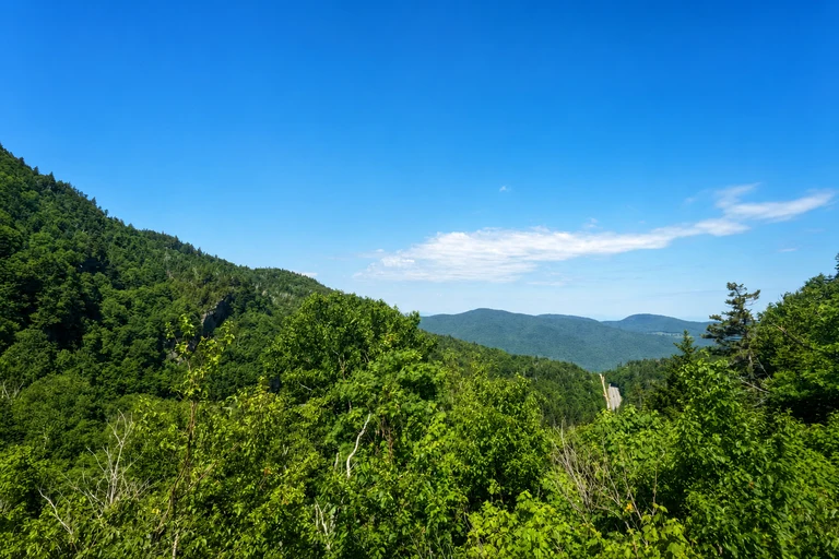
Appalachian Gap
Appalachian Gap supplies a mountain-pass viewpoint for the Vermont loop and is best treated as a brief 15–30 minute roadside stop. It adds elevation and open mountain scenery between the Route 100 area and the Woodstock or Quechee portion of the itinerary.
Vermont Route 17 is steep and winding in this area. Use designated pull-offs, avoid blind curves, and check current Vermont foliage and road reports before selecting the pass as a fixed part of Day 4.
AI-created illustrative image; not a documentary photographAnyMappy · AI-edited from a rights-cleared reviewed reference · AI-generated editorial imageImage source

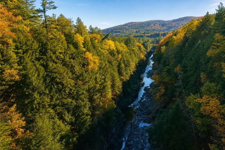
Quechee Gorge
Quechee Gorge is a flexible 45–90 minute stop on US Route 4, with bridge viewpoints and a possible descent on the park trail. It works as a high-impact Vermont stop without requiring a full-day hike and pairs naturally with Woodstock.
Stay behind barriers and account for the possibility of a state park day-use fee for facilities. The gorge is often busy, so the map should help decide whether to visit at the planned time or continue to another stop.
AI-created illustrative image; not a documentary photographAnyMappy · AI-edited from a rights-cleared reviewed reference · AI-generated editorial imageImage source
.jpg)
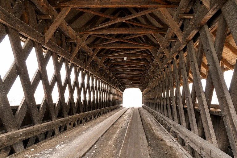
Middle Covered Bridge in Woodstock
Middle Covered Bridge combines a covered bridge with a walkable Woodstock village stop. It is a useful final Vermont attraction because travelers can park legally in town, explore on foot, and avoid adding another isolated roadside pull-off to the day.
The bridge remains part of a working street network, so do not block traffic for photographs. No attraction admission is listed, but town parking and local restrictions still matter; use the map to plan a legal walking approach.
AI-created illustrative image; not a documentary photographAnyMappy · AI-edited from a rights-cleared reviewed reference · AI-generated editorial imageImage source

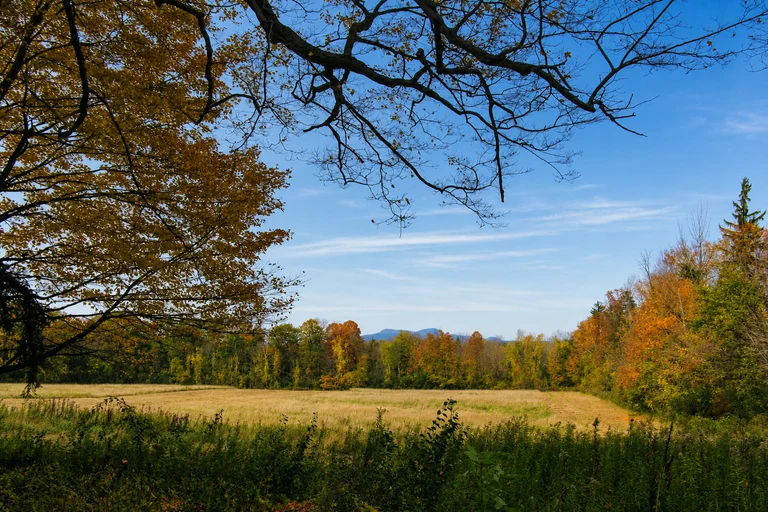
Mount Greylock Summit
Mount Greylock Summit is the most elevated-looking option on the Massachusetts return, with a seasonal auto road and viewpoint near Adams. Allow roughly one to two hours when conditions support the climb, and use it as the main Berkshires stop rather than assuming it must be combined with every other viewpoint.
The auto roads can close for weather, so check Massachusetts foliage information and DCR notices before departure. Summit parking may carry a fee, and the stop should be dropped or replaced if the seasonal road is not operating.
AI-created illustrative image; not a documentary photographAnyMappy · AI-edited from a rights-cleared reviewed reference · AI-generated editorial imageImage source

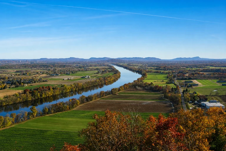
Mount Sugarloaf State Reservation
Mount Sugarloaf offers a Connecticut River Valley viewpoint farther south on the route toward Boston. Its seasonal summit road and hiking alternative make it a practical Day 5 choice when the return route favors the Connecticut Valley or when Mount Greylock’s road status does not work.
The summit road is narrow, seasonal, and may close; hiking access is an alternative when appropriate. Parking fees may apply when the summit road operates, so verify Massachusetts DCR notices and current access before committing.
AI-created illustrative image; not a documentary photographAnyMappy · AI-edited from a rights-cleared reviewed reference · AI-generated editorial imageImage source

Where should I stay on this five-day Boston foliage loop?
Use two nights around Lincoln or North Conway for the New Hampshire portion, followed by two nights around Woodstock or elsewhere in central Vermont. These bases limit hotel changes and reduce backtracking.
What is the best order for the New Hampshire stops?
A practical sequence is Albany Covered Bridge, Rocky Gorge Scenic Area, Sabbaday Falls, and Pemigewasset Overlook along the Kancamagus corridor, with Flume Gorge and Crawford Notch Depot handled as separate route segments. Use the map and current parking conditions to change the order when needed.
Are exact 2026 peak foliage dates available?
No. The listed late-September, early-October, and mid-October windows are historical planning ranges only. Exact 2026 color timing remains TBA until a live official foliage report confirms current conditions.
Why is Acadia not included?
Acadia would add excessive driving to a five-day loop that already covers the White Mountains, central Vermont, and the Berkshires. Excluding it preserves the two-night base structure and leaves more time for scenic stops.
Do I need reservations or passes?
Flume Gorge is ticketed and may use timed admission during foliage season. White Mountain National Forest recreation passes may be required at signed sites, Quechee Gorge may have a state park day-use fee, and summit parking fees may apply in Massachusetts. Verify current details before traveling.
What should I do if a Kancamagus pull-off is full?
Do not stop on the shoulder or circle indefinitely. Continue to the next mapped stop with legal parking, and check White Mountain National Forest alerts before departure. Starting early is particularly important on peak weekends.
Can I drive to both Mount Greylock and Mount Sugarloaf on Day 5?
They can serve as alternatives on the return rather than fixed requirements. Both summit roads are seasonal and may close, so check current Massachusetts DCR notices and choose the viewpoint that fits the live road conditions and return plan.