

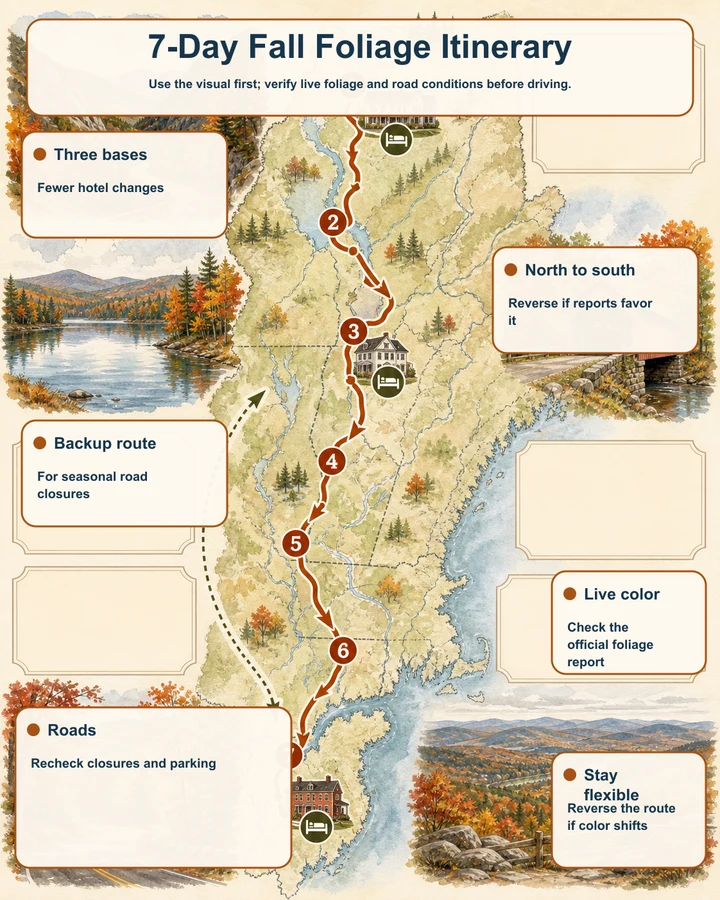
Use the visual first; verify live foliage and road conditions before driving.
- Three basesFewer hotel changes
- North to southReverse if reports favor it
- Backup routeFor seasonal road closures
- Live colorCheck the official foliage report
- RoadsRecheck closures and parking
- Stay flexibleReverse the route if color shifts
Use the map as your foliage decision tool
This itinerary is designed as a north-to-south shape: western Maine and the White Mountains first, northern or central Vermont next, and the Berkshires or Connecticut River Valley last. The map helps you see which overlooks, waterfalls, covered bridges, mountain passes, and summit roads fit naturally into each base rather than treating every stop as a separate destination.
Foliage timing is a planning range, not a promise. The listed stops commonly fall within late September to early October or early to mid-October windows, but exact 2026 color is TBA until current official reports confirm conditions. Check Maine, New Hampshire, Vermont, and Massachusetts reports before committing to the sequence.
The three-base strategy
Use a western Maine or White Mountains base for Days 1–3, a northern or central Vermont base for Days 4–5, and a Berkshires or Connecticut River Valley base for Days 6–7. This keeps the trip unhurried and leaves room for weather, parking, short walks, and seasonal road changes.
Think in approximate driving ranges rather than fixed arrival times: local scenic loops are the shortest days, cross-region transfers are the longer days, and peak-weekend traffic can change the day substantially. Keep the map open when choosing between a nearby overlook and a farther detour.
The seven-day route at a glance
<table><thead><tr><th>Day</th><th>Base and focus</th><th>Map stops</th><th>Driving plan</th></tr></thead><tbody><tr><td>1</td><td>Western Maine</td><td>Height of Land, Coos Canyon</td><td>Short regional scenic loop</td></tr><tr><td>2</td><td>Western Maine</td><td>Screw Auger Falls and Grafton Notch</td><td>Local-to-moderate loop</td></tr><tr><td>3</td><td>White Mountains</td><td>Crawford Notch Depot, Albany Covered Bridge, Pemigewasset Overlook</td><td>Longer transfer and scenic corridor</td></tr><tr><td>4</td><td>White Mountains</td><td>Artist's Bluff and optional second White Mountain stop</td><td>Short base day</td></tr><tr><td>5</td><td>Northern or central Vermont</td><td>Lake Willoughby South Beach, Smugglers' Notch alternative</td><td>Longer transfer; Route 100 backup</td></tr><tr><td>6</td><td>Central Vermont</td><td>Appalachian Gap, Mount Philo</td><td>Moderate scenic loop</td></tr><tr><td>7</td><td>Berkshires or Connecticut River Valley</td><td>Middle Covered Bridge, Mount Greylock or Mount Sugarloaf</td><td>Final transfer and short summit option</td></tr></tbody></table>
The table is a framework, not a peak-color guarantee. Use live reports to decide whether the northern stops belong earlier, whether Vermont should receive more time, or whether the final days should become the strongest color days.
Days 1–3: western Maine to the White Mountains
Begin with the lakes and mountain roads around Rangeley, using Height of Land and Coos Canyon as easy-to-pair roadside stops. Add Screw Auger Falls on a Grafton Notch day if the weather and road conditions suit a short waterfall and gorge visit. These stops provide visual variety without requiring a packed schedule.
On Day 3, shift toward the White Mountains and use Crawford Notch Depot, Albany Covered Bridge, and Pemigewasset Overlook as a scenic corridor. Pemigewasset is a high-demand stop, so the map should help you compare it with lower-traffic options when parking is full or peak-weekend traffic is heavy.
Days 4–5: White Mountains into Vermont
Keep Day 4 flexible around Franconia Notch. Artist's Bluff is a short but steep viewpoint hike, so treat it as a weather- and footing-dependent highlight rather than a guaranteed quick stop. A clear morning is useful for the lake-and-mountain view; wet conditions call for extra caution and more time.
Move into northern or central Vermont on Day 5, with Lake Willoughby South Beach as the eastern lake-and-mountain anchor. Smugglers' Notch is a strong visual option only when Route 108 is open and suitable for your vehicle. Because the notch road is seasonal and unsuitable for large vehicles, keep a Route 100 alternative visible on the map instead of assuming the pass will connect the day.
Days 6–7: central Vermont to the southern finish
Use Appalachian Gap for a compact mountain-pass viewpoint, then continue toward Mount Philo when the summit road is operating. Mount Philo also has a hiking alternative if vehicle access is unavailable, but the road is narrow and seasonal. Finish the Vermont portion with Middle Covered Bridge in Woodstock, allowing time to park legally and walk because the bridge remains part of a working street network.
For the final base, choose the Berkshires or Connecticut River Valley according to live reports and road notices. Mount Greylock supplies a seasonal summit-road option in the Berkshires; Mount Sugarloaf provides a Connecticut River Valley alternative. Both summit roads can close independently of foliage conditions, so keep the other destination available rather than building the day around a single drive-up viewpoint.
When to reverse the itinerary
Check official foliage reports 48–72 hours before departure. If the reports favor stronger color in the Berkshires or Connecticut River Valley while the northern areas remain early, reverse the trip: begin in Massachusetts, continue through Vermont, and finish in the White Mountains or western Maine.
An open-jaw plan works especially well for the reversed version: arrive near the southern end and depart near the northern end, or use the opposite arrangement for the north-to-south version. Confirm vehicle access, parking rules, and seasonal road status for each map stop before locking in lodging.
Weather and road fallback logic
Use lower-commitment stops when clouds, rain, or poor visibility affect summit views. Covered bridges, roadside overlooks, river stops, and waterfall areas can keep a day worthwhile without requiring a summit road or exposed viewpoint. Coos Canyon, Crawford Notch Depot, Albany Covered Bridge, Middle Covered Bridge, and Height of Land all fit this style of adjustment, subject to current notices and safe access.
Treat summit roads as independent decisions. Mount Greylock, Mount Philo, and Mount Sugarloaf can close even when nearby roads and foliage areas remain accessible. Smugglers' Notch requires its own closure check, while Route 100 is the planned Vermont fallback. Never stop on blind curves or outside marked pull-offs.
Practical rules for an unhurried week
Keep one flexible block in each base rather than adding another hotel change. Start popular stops earlier when possible, especially Artist's Bluff, Pemigewasset Overlook, Smugglers' Notch, and Middle Covered Bridge, where parking or narrow access can shape the visit more than the distance on the map.
Use official reports for live color, park agencies for closures and fees, and the map for current sequencing. Attraction admission is generally not the main planning issue here, but state park day-use fees, summit parking fees, forest recreation passes, and seasonal facility rules can apply at individual stops.
Places in this article
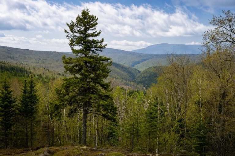
Height of Land Scenic Overlook
Height of Land is a quick, high-value opening stop near Rangeley, with a broad lake-and-landscape view that works well in a western Maine base day. Its roadside position makes it useful when you want strong scenery without committing to a long walk.
Use the marked pull-off and stay clear of highway traffic. The planning window is late September to early October, but Maine’s weekly foliage report should determine timing; there is no attraction admission.
AI-created illustrative image; not a documentary photographAnyMappy · AI-edited from a rights-cleared reviewed reference · AI-generated editorial imageImage source
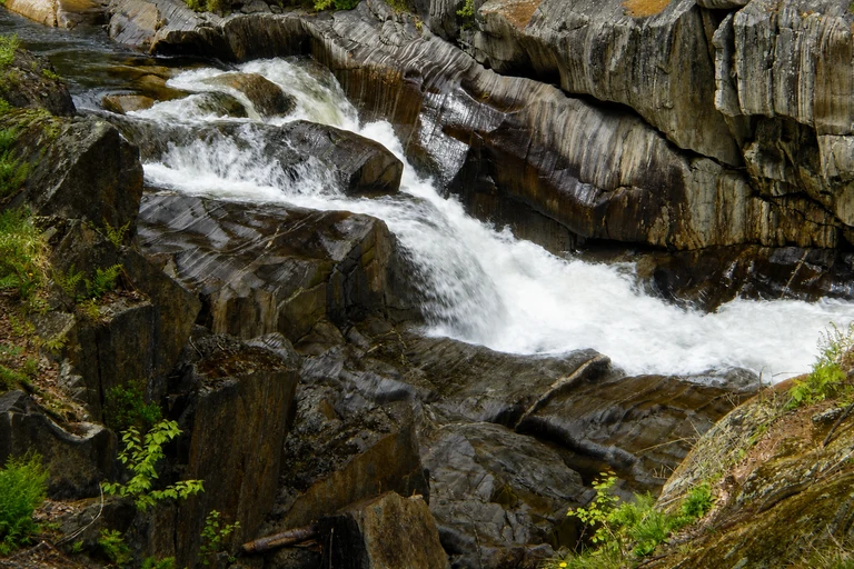
Coos Canyon
Coos Canyon adds a river-and-gorge perspective to the Rangeley portion of the route and pairs naturally with Height of Land on a western Maine loop. Its picnic-stop character gives the itinerary a lower-intensity option between overlooks and longer drives.
Stay on maintained access points because wet rocks and river currents can be hazardous. The roadside rest area has no attraction admission; verify current access information through Maine’s foliage and road resources.
AI-created illustrative image; not a documentary photographAnyMappy · AI-edited from a rights-cleared reviewed reference · AI-generated editorial imageImage source

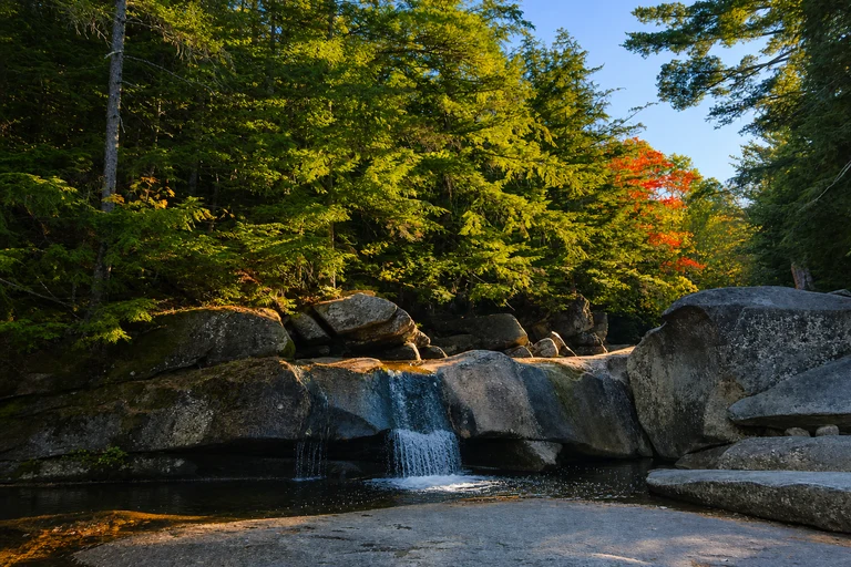
Screw Auger Falls
Screw Auger Falls is the focused waterfall stop for a Grafton Notch day, with a short walk from the parking area and a visit length that fits comfortably into an unhurried Maine base. It is especially useful when you want a scenic change from open lake overlooks.
Stay behind railings and check state park notices before departure. A state park day-use fee may apply, and late September to early October is only a historical planning range pending Maine’s current report.
AI-created illustrative image; not a documentary photographAnyMappy · AI-edited from a rights-cleared reviewed reference · AI-generated editorial imageImage source

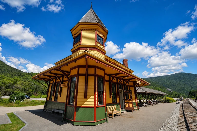
Crawford Notch Depot
Crawford Notch Depot gives Day 3 a historic and valley-focused stop within the White Mountains. It is a useful middle point between mountain scenery and the broader Crawford Notch corridor, with a moderate visit length rather than a full hike.
Access is roadside near the historic depot, so confirm seasonal facilities and trail conditions. Roadside viewing is free, but nearby parking or attractions may have separate rules.
AI-created illustrative image; not a documentary photographAnyMappy · AI-edited from a rights-cleared reviewed reference · AI-generated editorial imageImage source

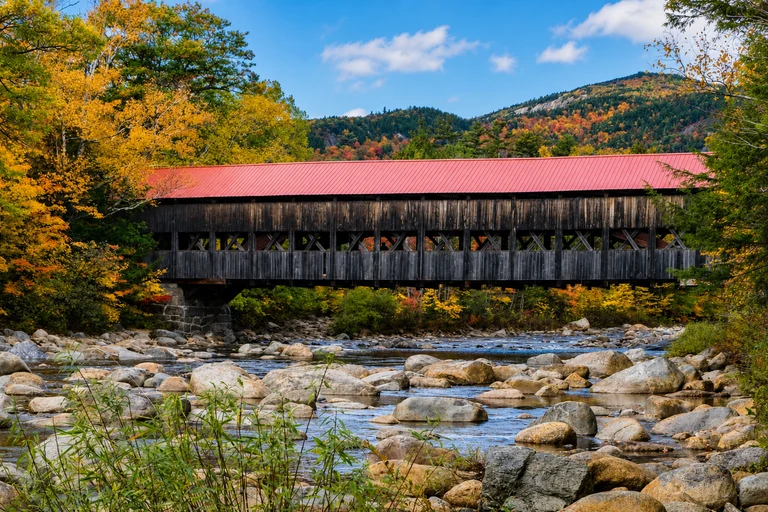
Albany Covered Bridge
Albany Covered Bridge brings a river and covered-bridge scene to the Kancamagus Highway day. Its short walk and family-friendly format make it a practical counterpoint to overlooks, particularly when visibility is limited at higher elevations.
Check White Mountain National Forest alerts before departure and follow signed parking or recreation-pass requirements. The historical color range is late September to early October, subject to the live New Hampshire report.
AI-created illustrative image; not a documentary photographAnyMappy · AI-edited from a rights-cleared reviewed reference · AI-generated editorial imageImage source
.jpeg)
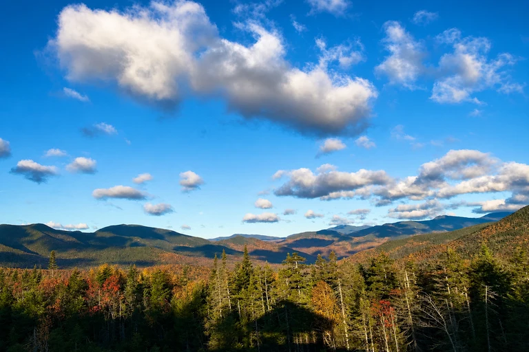
Pemigewasset Overlook
Pemigewasset Overlook is the broad mountain-view anchor on the Kancamagus section and works best as a brief, map-selected stop rather than a long activity. It can also be a strong late-day viewpoint when conditions provide visibility.
Parking fills quickly during peak weekends, so keep a nearby alternative in view and avoid promising a fixed arrival time. There is no separate attraction admission, but obey signed parking and pass requirements.
AI-created illustrative image; not a documentary photographAnyMappy · AI-edited from a rights-cleared reviewed reference · AI-generated editorial imageImage source
.jpg)
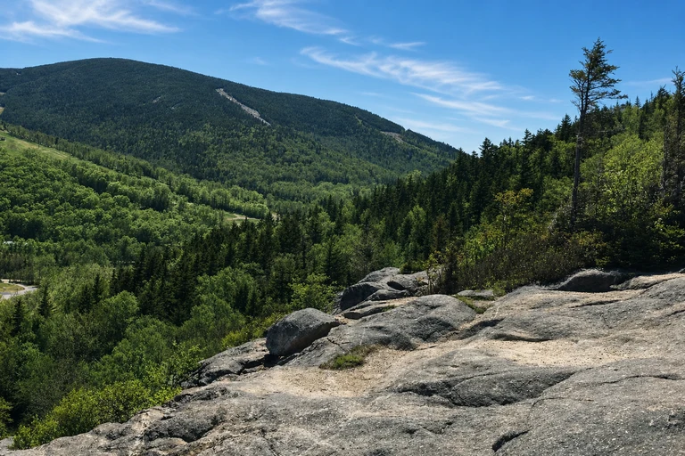
Artist's Bluff
Artist’s Bluff is the most hike-oriented White Mountains stop in this plan, offering a lake view from a short but steep route. Its decision value is high when skies are clear and footing is good, but it should not be treated as an effortless roadside stop.
Use the signed trailhead and legal parking only. The trail can be muddy, nearby attractions may charge admission, and current New Hampshire foliage reports should guide the timing.
AI-created illustrative image; not a documentary photographAnyMappy · AI-edited from a rights-cleared reviewed reference · AI-generated editorial imageImage source

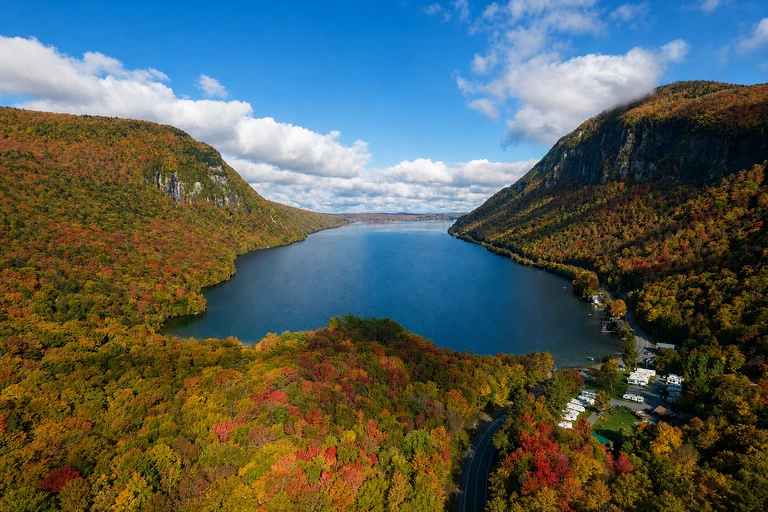
Lake Willoughby South Beach
Lake Willoughby South Beach shifts the itinerary from White Mountain valleys to a broad lake-and-mountain setting in Vermont’s Northeast Kingdom. It is a flexible stop for a northern Vermont base, with enough time for a brief view or a slower shoreline visit.
Use designated beach and roadside parking, and remember that cold-water and weather conditions can change quickly. Access rules vary by season and managed area, so check current notices before relying on the stop.
AI-created illustrative image; not a documentary photographAnyMappy · AI-edited from a rights-cleared reviewed reference · AI-generated editorial imageImage source

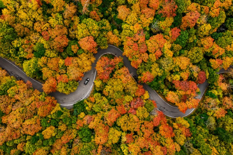
Smugglers' Notch State Park
Smugglers’ Notch delivers a concentrated mountain-notch experience, with boulder scenery and a short walking option near Stowe. It is a strong visual centerpiece for Vermont when Route 108 is open and traffic conditions allow a measured visit.
The narrow road is seasonal and unsuitable for large vehicles, so closure status must be checked before driving. A park day-use fee may apply when facilities operate; keep Route 100 as the map-based alternative.
AI-created illustrative image; not a documentary photographAnyMappy · AI-edited from a rights-cleared reviewed reference · AI-generated editorial imageImage source

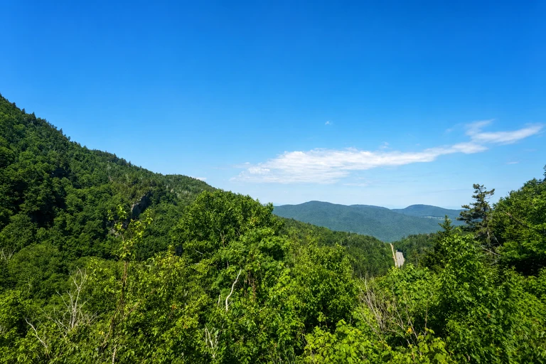
Appalachian Gap
Appalachian Gap is a compact mountain-pass stop for the transition through central Vermont. It works well as a short viewpoint between larger destinations and helps preserve the itinerary’s unhurried character without requiring a summit-road commitment.
The approach is steep and winding. Use designated pull-offs and never stop on blind curves; there is no attraction admission. Confirm road and weather conditions before setting out.
AI-created illustrative image; not a documentary photographAnyMappy · AI-edited from a rights-cleared reviewed reference · AI-generated editorial imageImage source

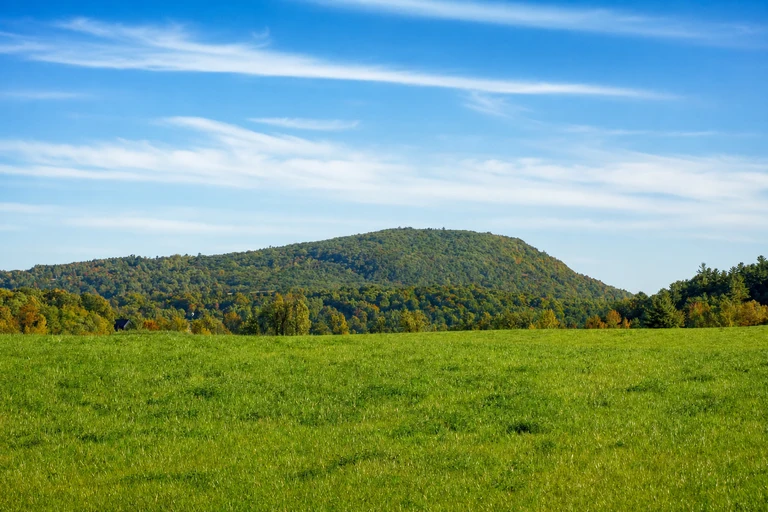
Mount Philo State Park
Mount Philo provides a Champlain Valley summit perspective and can anchor a central Vermont day after Appalachian Gap. The drive-up format is convenient when the summit road is open, while the hiking alternative keeps the location useful when vehicle access changes.
The summit road is narrow and seasonal, and a state park day-use fee applies during the operating season. Check current park notices and live foliage reports rather than assuming the road will be operating.
AI-created illustrative image; not a documentary photographAnyMappy · AI-edited from a rights-cleared reviewed reference · AI-generated editorial imageImage source

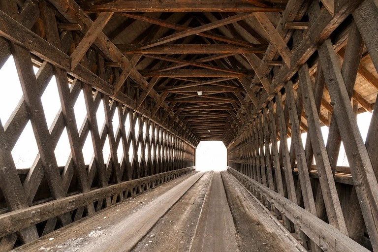
Middle Covered Bridge
Middle Covered Bridge adds a walkable village stop to the final Vermont portion of the route. It is valuable as a slower visual interlude after mountain roads and pairs naturally with Woodstock rather than requiring a separate day.
Park legally in town and explore on foot; the bridge remains part of a working street network. There is no attraction admission, but the location can be busy during the early-to-mid-October planning window.
AI-created illustrative image; not a documentary photographAnyMappy · AI-edited from a rights-cleared reviewed reference · AI-generated editorial imageImage source

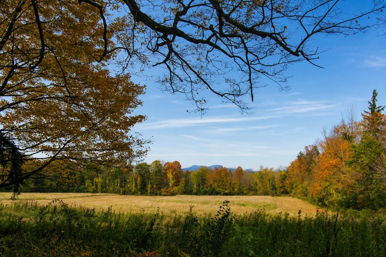
Mount Greylock Summit
Mount Greylock is the Berkshires summit option for the final base, offering a high-elevation finish when the seasonal auto roads and visibility cooperate. It gives the southbound itinerary a distinct mountain endpoint instead of repeating the Vermont valley experience.
The auto roads can close for weather, so check Massachusetts foliage and DCR road reports before the climb. Summit parking may carry a fee, and a closure should prompt a different map stop rather than a fixed assumption.
AI-created illustrative image; not a documentary photographAnyMappy · AI-edited from a rights-cleared reviewed reference · AI-generated editorial imageImage source

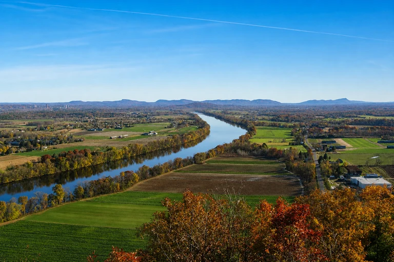
Mount Sugarloaf State Reservation
Mount Sugarloaf is the Connecticut River Valley alternative, pairing a seasonal summit-road viewpoint with a river-valley setting. It is useful when the final base is farther east than the Berkshires or when the map favors southern Massachusetts color.
The summit road is seasonal, narrow, and may close; hiking access is an alternative when conditions and access allow. Parking fees may apply when the summit road operates, so check current DCR notices before departure.
AI-created illustrative image; not a documentary photographAnyMappy · AI-edited from a rights-cleared reviewed reference · AI-generated editorial imageImage source

Can this seven-day New England foliage route be reversed?
Yes. Check live official foliage reports 48–72 hours before departure. If reports favor stronger color in southern New England, begin in the Berkshires or Connecticut River Valley and travel north, keeping the same three-base structure.
How many hotel changes does this itinerary require?
Plan on three bases: western Maine or the White Mountains, northern or central Vermont, and the Berkshires or Connecticut River Valley. The goal is to avoid changing hotels every night.
What is the best backup for Smugglers' Notch?
Keep Vermont Route 100 visible on the map. Smugglers' Notch Road is seasonal, can close, and is unsuitable for large vehicles, so Route 100 should remain the planned alternative rather than an afterthought.
Are exact 2026 peak-color dates available?
No exact 2026 color dates should be promised in advance. The stop windows are historical planning ranges only; verify current conditions through official weekly foliage reports before and during the trip.
What if a summit road is closed?
Use the map to switch to a roadside overlook, covered bridge, waterfall, lake stop, or hike. Mount Greylock, Mount Philo, and Mount Sugarloaf summit roads can close independently of foliage conditions, and Mount Philo and Mount Sugarloaf have hiking alternatives when access and conditions permit.