


Use the visual first; verify live foliage and road conditions before driving.
- Shift the timeWeekdays and early starts
- Keep alternativesNever assume a site is empty
- Protect accessLegal parking and land rules
- Live colorCheck the official foliage report
- RoadsRecheck closures and parking
- Stay flexibleReverse the route if color shifts
Use the map to build a lower-pressure foliage day
The map is designed for comparison, not a promise of solitude. Filter among roadside overlooks, waterfalls, lakes, short trails, historic sites, and parks, then look at how each pin fits into a scenic drive. A medium-crowd stop may still feel busy at peak color, while a lower-crowd stop can attract visitors when conditions are especially good.
Start with the state and landscape you want, rather than following every famous viewpoint in sequence. Crawford Notch and Route 100 offer mountain-valley and waterfall stops; western Maine adds lake overlooks, gorges, and a state park; southern New England provides summits, historic villages, forests, ponds, and an urban-edge lake park.
Shift the clock before you change the destination
Weekdays and times outside midday are the most practical pressure-reduction tools when access rules allow. An early start can make a short roadside stop easier to use, while a later visit may work at a park or historic site with posted hours. Check parking, seasonal facilities, summit-road operations, and trail notices before leaving.
Use the map to make one primary stop and one or two backups instead of adding a long chain of famous viewpoints. The typical windows listed below are historical planning ranges only: late September to early October in many northern and mountain locations, early to late October in western Massachusetts, mid-October in northwest Connecticut, and mid to late October in southern New England. Exact 2026 color timing remains TBA until a live official report confirms current conditions.
Plan for access, traffic, and seasonal hazards
Only use signed parking areas and legal pull-offs. Never stop in a travel lane or on a blind curve because a view looks promising. This matters especially on winding mountain roads such as Vermont Route 17 and at roadside overlooks along Maine Route 17. A map pin is a destination reference, not permission to park outside the marked access area.
Conditions vary by site. Wet rocks, river currents, cold water, changing weather, narrow summit roads, and seasonal closures can affect a visit. At multi-use public lands, follow the current land-manager notices and wear high-visibility colors where advised during hunting seasons. At villages and historic properties, keep roads clear, respect posted hours, and avoid treating residential areas as informal parking lots.
Swap a full corridor for a focused stop
A lower-pressure itinerary does not require abandoning classic drives. Instead, use a single map pin to replace part of a day spent repeating the same crowded overlook pattern. A depot can add history to a mountain route, a lake can replace another roadside photo stop, and a short waterfall walk can provide a defined destination with less time spent searching for a view.
Keep the comparison practical: choose the landscape you want, confirm the access caveat, and arrive when the site can legally receive visitors. Medium-crowd alternatives remain capable of filling at peak color, so retain a backup pin in a different setting rather than assuming the first stop will be quiet.
A quieter trip is a better-timed, better-mapped trip
New England foliage without the crowds is a planning exercise, not a search for an untouched secret. The strongest itinerary pairs a live foliage check with weekday or off-midday timing, legal parking, realistic visit lengths, and a backup stop.
Use the map to trade repetition for variety: mountain passes, lakes, gorges, waterfalls, summits, historic places, and managed forests all offer different ways to see the season. Leave room for changing access conditions, and let the official state reports—not a fixed calendar—decide when to go.
Places in this article
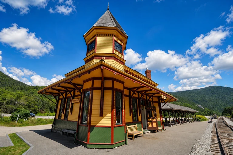
Crawford Notch Depot, New Hampshire
This historic depot and valley stop gives a Crawford Notch itinerary a defined, history-focused destination rather than a day built around repeated mountain pull-offs. Its medium crowd level and 30–60-minute visit length make it useful for a focused stop on US 302, especially when you want rail and valley context.
Roadside access is near the depot, but seasonal facilities and trail conditions need confirmation. Roadside viewing is free; parking or nearby attractions may have separate rules. Use the map pin for the marked access area, not for an improvised roadside stop.
AI-created illustrative image; not a documentary photographAnyMappy · AI-edited from a rights-cleared reviewed reference · AI-generated editorial imageImage source
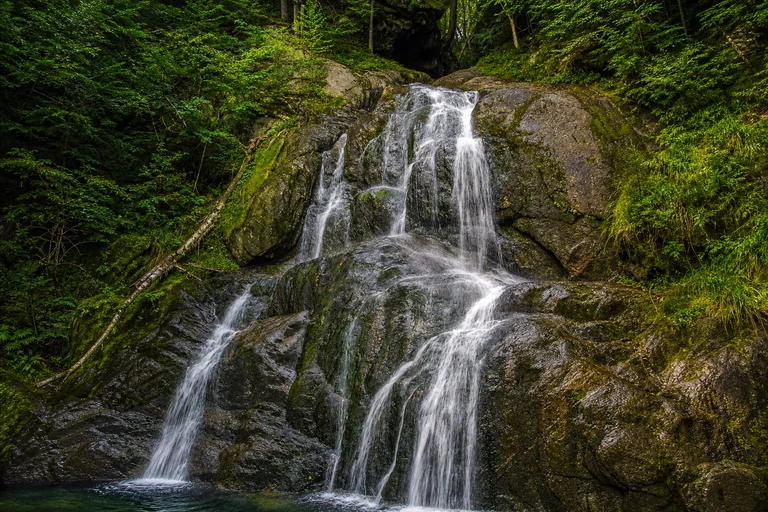
Moss Glen Falls, Vermont
Moss Glen Falls offers a short, clearly defined waterfall stop along Vermont Route 100. It can replace spending the entire day searching for roadside views, while the 20–40-minute visit length leaves room for another mapped destination. Its crowd level is medium, so the signed pull-off may still feel busy during peak color.
Use the signed pull-off and boardwalk, and never stop in the travel lane. No attraction admission is normally required. Treat late September to mid-October as a planning range only and check Vermont's live foliage reports before routing the day.
AI-created illustrative image; not a documentary photographAnyMappy · AI-edited from a rights-cleared reviewed reference · AI-generated editorial imageImage source
_2_(49437678742).jpg)
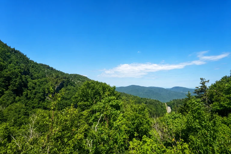
Appalachian Gap, Vermont
Appalachian Gap is a compact mountain-pass alternative for travelers who want elevation and a defined overlook without making every stop a major hike. The 15–30-minute visit can punctuate a Vermont Route 17 drive and replace a longer search for a view along the corridor. Crowd pressure is medium, not negligible.
Route 17 is steep and winding. Use designated pull-offs and avoid blind curves or any roadside stopping that is not legal. Check Vermont's live foliage reporting for current conditions rather than relying on the late-September-to-early-October historical window.
AI-created illustrative image; not a documentary photographAnyMappy · AI-edited from a rights-cleared reviewed reference · AI-generated editorial imageImage source

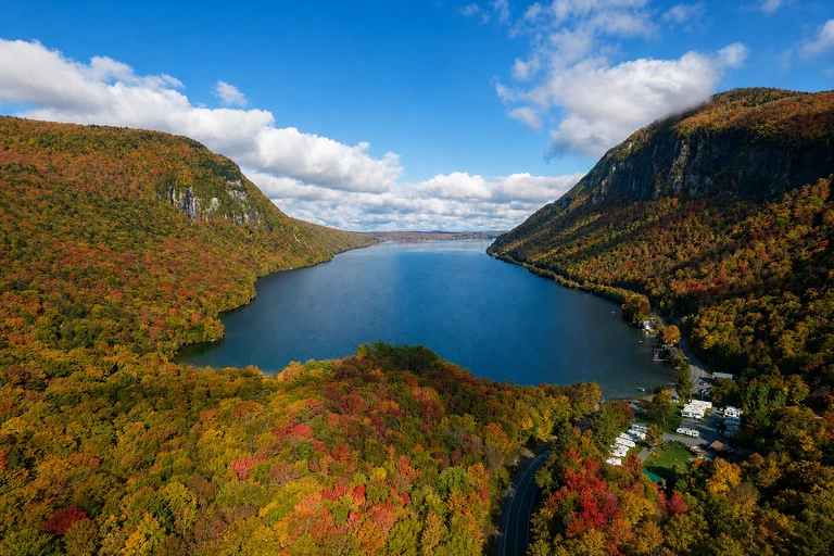
Lake Willoughby South Beach, Vermont
Lake Willoughby brings a lake-and-mountain viewpoint into the itinerary, giving the Northeast Kingdom a different visual rhythm from a continuous mountain-road loop. A 30–90-minute visit can replace another overlook and provides time for a deliberate shoreline stop. The site is medium crowd level, so a scenic lake does not guarantee low pressure.
Use designated beach and roadside parking. Cold-water and weather conditions can change quickly, and access rules vary by season and managed area. Check current notices before going, then use the map to pair this stop with a backup rather than assuming the beach will be quiet.
AI-created illustrative image; not a documentary photographAnyMappy · AI-edited from a rights-cleared reviewed reference · AI-generated editorial imageImage source

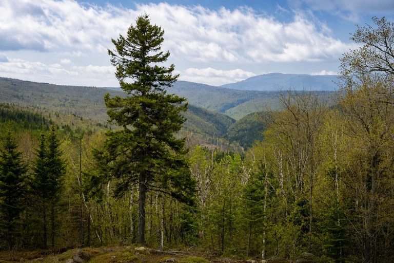
Height of Land Scenic Overlook, Maine
Height of Land is a concise lake-view stop on the Rangeley Lakes National Scenic Byway. Its 15–30-minute visit works as a focused alternative to repeatedly stopping along western Maine roads, particularly when the goal is a broad water-and-forest panorama. The crowd level is medium, so arrival timing still matters.
Use the marked pull-off and remain clear of highway traffic. There is no attraction admission, but the overlook is beside an active route. Late September to early October is a historical planning range; verify Maine's weekly foliage report before choosing the day.
AI-created illustrative image; not a documentary photographAnyMappy · AI-edited from a rights-cleared reviewed reference · AI-generated editorial imageImage source

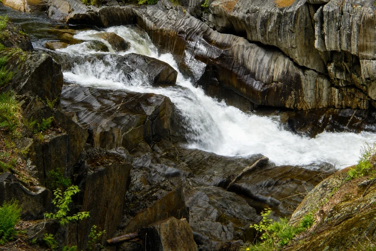
Coos Canyon, Maine
Coos Canyon adds a gorge, river, and picnic setting to the Rangeley Lakes National Scenic Byway. It can replace a string of unplanned roadside photo stops with a 30–60-minute destination and a different kind of foliage foreground. The roadside rest area has medium crowd pressure and may still draw visitors at peak color.
Stay on maintained access points. Wet rocks and river currents can be hazardous, even when the stop looks easy from the road. The roadside rest area has no attraction admission; confirm the live Maine foliage report before using the historical late-September-to-early-October window.
AI-created illustrative image; not a documentary photographAnyMappy · AI-edited from a rights-cleared reviewed reference · AI-generated editorial imageImage source

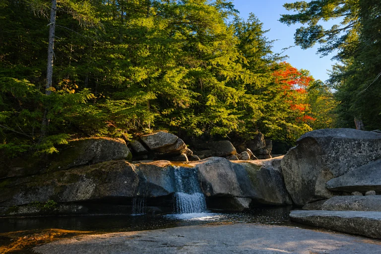
Screw Auger Falls, Maine
Screw Auger Falls provides a short walk to a waterfall and gorge within Grafton Notch State Park. It is a practical alternative to spending the whole ME 26 drive chasing viewpoints, with a 30–60-minute visit that gives the itinerary a clear anchor. Its crowd level is medium, so choose a weekday or non-midday period when access rules allow.
The falls are a short walk from the parking area. Stay behind railings and check state park notices; a day-use fee may apply. Use the late-September-to-early-October range only for planning and confirm Maine's weekly foliage report before traveling.
AI-created illustrative image; not a documentary photographAnyMappy · AI-edited from a rights-cleared reviewed reference · AI-generated editorial imageImage source

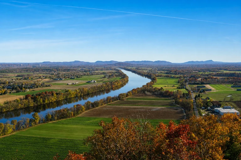
Mount Sugarloaf State Reservation, Massachusetts
Mount Sugarloaf offers a summit viewpoint over the Connecticut River Valley and can replace a more crowded, drive-only foliage plan with a destination that combines a possible drive-up view and hiking access. Allow 1–2 hours, and treat its medium crowd level as a reason to shift arrival time rather than expect an empty summit.
The summit auto road is seasonal, narrow, and may close; hiking access is an alternative. A parking fee may apply when the summit road operates. Check Massachusetts foliage information and DCR road reports, with early to late October used only as a planning range.
AI-created illustrative image; not a documentary photographAnyMappy · AI-edited from a rights-cleared reviewed reference · AI-generated editorial imageImage source

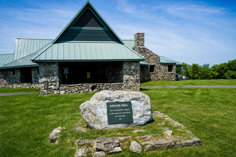
Dennis Hill State Park, Connecticut
Dennis Hill is a lower-crowd summit and pavilion option for northwest Connecticut, with short trails and a 1–2-hour visit. It can replace a busier scenic-byway stop when you want a contained highland outing rather than a sequence of roadside viewpoints. Lower crowd level means relatively lower pressure, not guaranteed solitude.
Seasonal road access and facilities vary, so check Connecticut Parks notices before setting the route. A nonresident parking fee may apply. Use mid-October only as a historical planning range and confirm Connecticut's current foliage report.
AI-created illustrative image; not a documentary photographAnyMappy · AI-edited from a rights-cleared reviewed reference · AI-generated editorial imageImage source
.JPG)
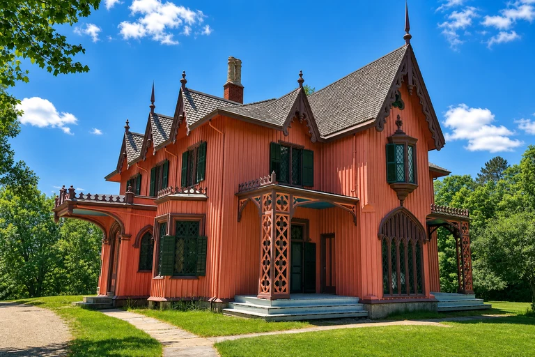
Roseland Cottage, Connecticut
Roseland Cottage offers a lower-crowd historic-house and village stop along Route 169 National Scenic Byway. It is a useful alternative to an itinerary focused only on overlooks, with a 30–90-minute visit that adds architecture and local character. The setting works best when you want a deliberate stop rather than another roadside pause.
Exterior viewing and site access depend on posted hours, and grounds and tours may have different access or admission rules. Route 169 is a working two-lane road, so keep traffic clear and follow posted parking guidance. Check Connecticut's current foliage report instead of assuming mid-to-late October conditions.
AI-created illustrative image; not a documentary photographAnyMappy · AI-edited from a rights-cleared reviewed reference · AI-generated editorial imageImage source

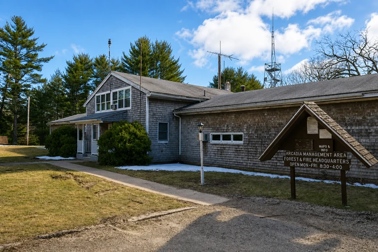
Arcadia Management Area, Rhode Island
Arcadia Management Area is a lower-crowd choice for forest roads, ponds, and trails in southern Rhode Island. Its 1–3-hour visit can replace a busier foliage corridor with a flexible, multi-use landscape, but the map should guide you to lawful access rather than encourage aimless back-road driving. Lower pressure does not mean private or empty.
This is an active management area. Follow Rhode Island DEM notices, use designated access, and wear high-visibility colors during hunting seasons when officials advise it. Check current Rhode Island foliage conditions before relying on the mid-to-late-October planning range.
AI-created illustrative image; not a documentary photographAnyMappy · AI-edited from a rights-cleared reviewed reference · AI-generated editorial imageImage source

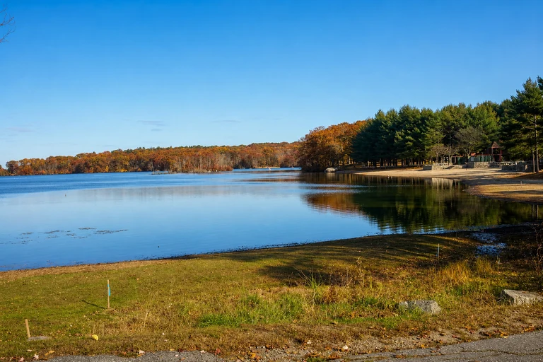
Lincoln Woods State Park, Rhode Island
Lincoln Woods provides a lake loop and walkable park setting near Providence, making it a practical alternative when a full rural foliage drive is not necessary. A 1–2-hour visit can deliver water, trees, and a defined route without committing the day to a distant scenic corridor. Its crowd level is medium, so expect more pressure at popular times.
Follow posted one-way and parking rules, and remember that trail and beach services are seasonal. General park access is typically free, while specific seasonal services may differ. Verify Rhode Island foliage conditions before planning around the mid-to-late-October range.
AI-created illustrative image; not a documentary photographAnyMappy · AI-edited from a rights-cleared reviewed reference · AI-generated editorial imageImage source

Can any of these New England foliage stops guarantee solitude?
No. Lower crowd level means relatively lower pressure, not an empty site. Any stop can become busy around peak color, especially during midday or on favorable weekend weather.
When should I visit for fewer people?
Start with weekdays and times outside midday when access rules allow. Confirm posted hours, parking rules, seasonal facilities, and current notices before visiting.
Are the foliage dates exact for 2026?
No. The listed late-September-through-October windows are historical planning ranges. Exact 2026 color timing is TBA until a live official state foliage report confirms current conditions.
Can I pull over anywhere for a scenic view?
No. Use only signed parking areas and legal pull-offs. Do not stop in a travel lane, on a blind curve, or on a roadside shoulder simply because a viewpoint looks attractive.
What safety issue matters most on quieter public lands?
Follow current land-manager notices. In multi-use areas such as Arcadia Management Area, wear high-visibility colors where officials advise it during hunting seasons. Also watch for wet rocks, river currents, cold water, changing weather, and seasonal access changes.